|
Bourne from the air
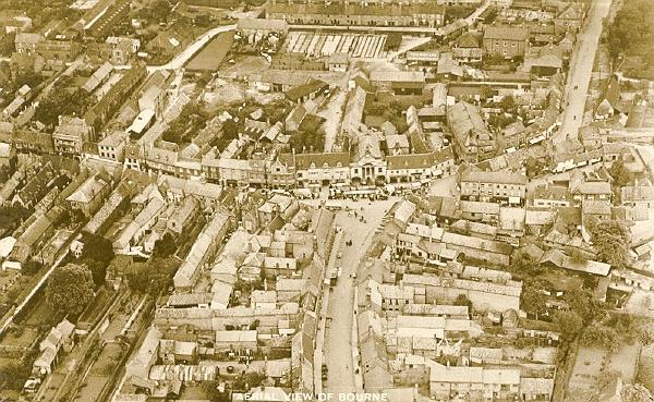
These remarkable pictures showing Bourne from the air on market day were taken more than 70 years ago when they were commissioned by the Lincolnshire, Boston and Spalding Free Press and published as postcards for its readers. The clock tower on the town hall is intact and so the pictures may be dated before October 1933 when it was destroyed by fire. The stalls of of the weekly market can be seen along the pavement in the Market Square and it is is easy to identify the many buildings that have disappeared from the street scene. The photograph below was taken by the late Mr Jim Goode, a local solicitor who had a pilot's licence. Mr Goode, who lived at Rippingale, was a partner with the law firm Andrews Stanton and Ringrose whose chambers are in North Street, and he was also clerk to the Bourne United Charities. Mr Goode owned his own aeroplane which he flew from the Fenland Aero Club's airfield near Holbeach and he took to the skies in the summer of 1973 to capture this fascinating photograph of Bourne. It is quite easy to follow your way around the town once you have established the main features such as the Abbey Church, the Red Hall, the Wellhead Gardens and the Abbey Lawn, all of which are easily distinguishable.
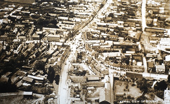
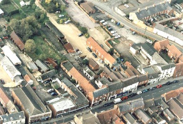
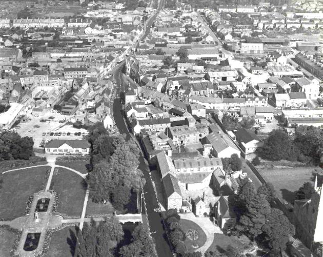
Three more recent shots from the air, taken circa 1990, this time showing the town centre from a much lower altitude, and reproduced here by courtesy of the Bourne branch of the Lincolnshire Family History Society who use them as part of their periodic public displays about Bourne and its past. The first photograph shows the Market Place, North Street and the north side of West Street while the picture below that shows the west side of North Street as far as Bourne Bookworld with the Burghley Centre opposite. The picture at the bottom shows the north side of North Street as far as Burghley Street, including Wake House on the right. 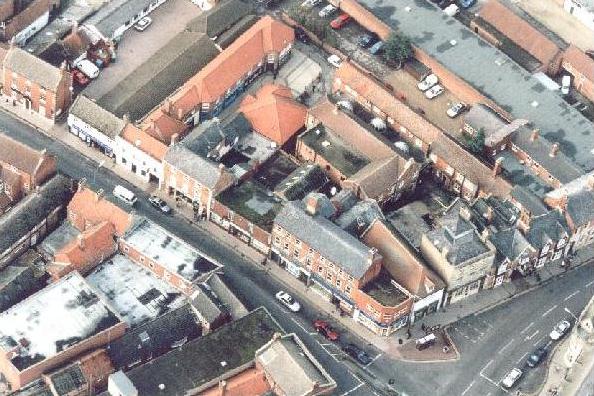
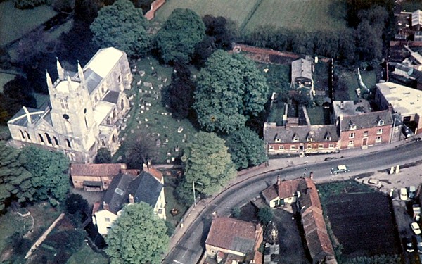
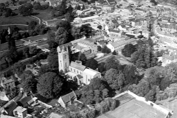
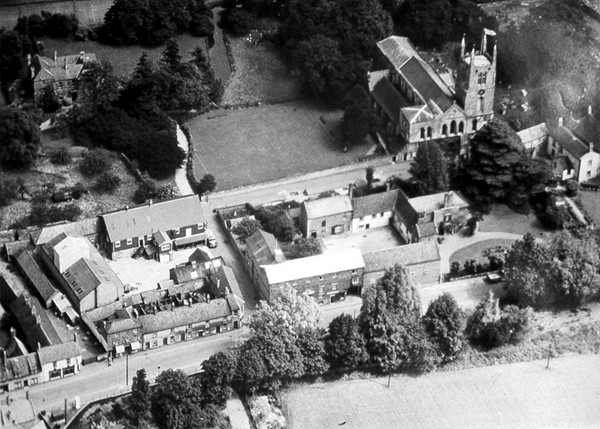
The colour photograph above and the three in black and white below show the Abbey Church, Church Walk and surrounding area and were taken circa 1960, before Mrs Alice Gray's farm cottage at No 35 South Street was demolished. The War Memorial can be seen on the left and beyond that the Wellhead gardens while to the right lies the built up area of the town centre.
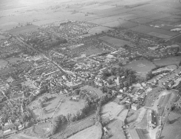
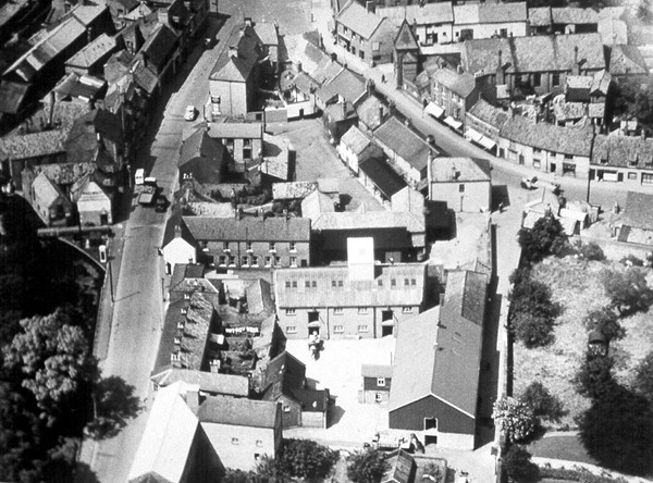
The aerial shot of Bourne below can be safely dated as circa 1970. The Ostler memorial fountain is missing from the market place, removed in 1960 because it was a traffic hazard, and there are no traffic lights which were not installed until 1973. The old pea factory owned by Wherry and Sons Ltd can still be seen in Church Walk and the northern section of the old grain warehouse, demolished circa 1985, is still in evidence in South Street, next to Bourne Eau House, while the cattle market, closed in 1981 and the site re-developed in 1988-90, can be seen in great detail, including the cattle pens. The picture also shows how few motor cars there were on the roads and in the South Street car park, a situation that would not be found today even at off peak periods. There were no yellow lines and far fewer road signs than today while South Street is in the process of being resurfaced and the warning signs can be seen at the entrance from the market place, opposite the Nag's Head.
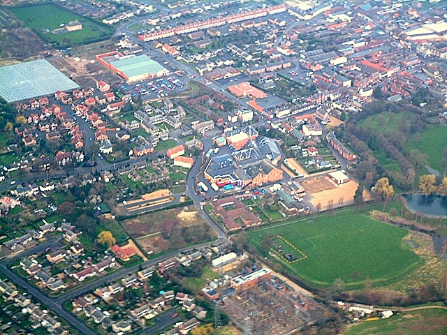
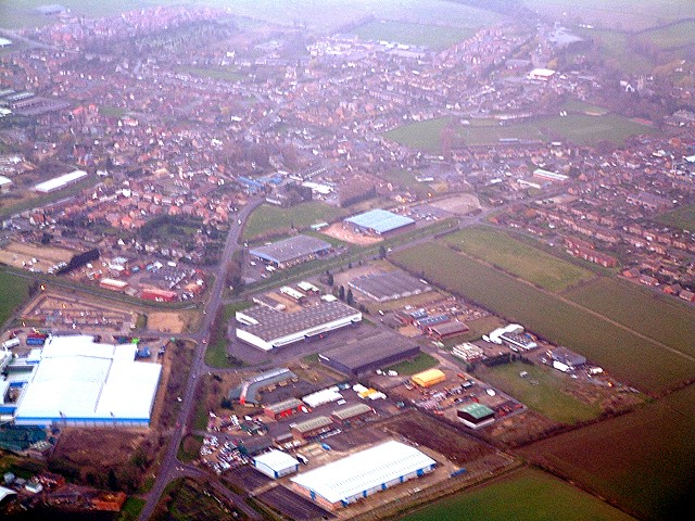
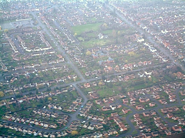
The three pictures below was taken at 4.09 pm on 2nd March 2002 by Frank Croom from a Cessna aircraft flying from Conington airfield near Huntingdon in Cambridgeshire. The first clearly shows the distinctive line of houses in Woodview, the expanding complex of the printing firm Warners (Midlands) plc and the adjoining site of St Peter's Hospital that had recently been demolished, Sainsburys supermarket, the Hereward medical centre, the greenhouses owned by E N Moody and Sons Ltd., nurserymen, which were then being pulled down to make way for a new housing scheme, St Peter's Pool and the Wellhead field. Bourne's expanding businesses along the Spalding Road can be seen in the second photograph and also visible are the junctions with Meadow Drove and Manning Road while the Rainbow supermarket is the large building with the green roof. The last picture gives an idea of how Bourne is expanding as a residential centre showing houses along Queens Road, Edinburgh Crescent and Northfields with The Croft in North Road just visible in the centre.
Go to: Main Index Villages Index
|