|
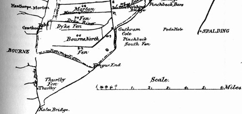
Guthram Gowt
The hamlet of Guthram Gowt is little
more than a bus stop today on the road from Bourne to Spalding but in past
times it became significant for the establishment of an engine or pumping
station for Bourne North Fen which was built during the 18th century by
the adventurers who provided the money to reclaim thousands of acres of
fen for productive agriculture.
The name Guthrum comes from the Danish chief who settled here and the word
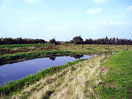
gote of gowt is peculiar to the fens and marshes being
derived from the Saxon and referring to a construction or connection with
drainage, notably a sluice or outflow, and has been in use ever since the
first steam engine was installed around 1766, a pumping station powered by
a wind driven scoop wheel pump which was replaced in the late 19th century
by a steam powered drainage engine following the Acts of Parliament of
1841 and 1843. "The machinery for lifting the water off the fen is situated on the side of the Forty Foot drain at Gutheram Cote (sic) and was erected by the Butterly Iron Company. It consists of a condensing beam engine of 30 NHP, the boiler pressure being originally 6 lbs. but now increased to 9 lbs. The cylinder is 45 inches in diameter and the stroke 6 ft. The engine works an iron scoop wheel, 15ft. in diameter, and 4ft. 3in. wide, having 30 scoops, their length being 3ft. 10in. The dip is regulated by a vertical shuttle placed near the wheel, and the dip allowed being about 2ft. "The maximum lift is 4ft., the head and dip
being 6ft. The engines are stopped when this lift is attained, as the
water is then level with the gauge fixed under the clause in the Act. The
wheel makes 4.5 revolutions a minute and the engine 19. With a full head,
2.5 tons of coal are consumed in 24 hours. This gives a coal consumption
of 200.37 lbs. per horse power, per hour, of water actually lifted, which
is very extravagant, modern engines and centrifugal pumps running with a
consumption of 4.5lbs. per hour; whilst the maximum allowed by the Dutch
authorities is 6.60lbs. Wheeler also describes how proposals for a
replacement engine were made in 1881, but were not taken up before his
book was published. However in 1895, the scoop wheel was replaced: with a
20-inch (510 mm) centrifugal pump made by Easton & Anderson. Then in 1918,
the steam engine was replaced by a 50 hp (37 kW) horizontal gas engine
which drove the Easton and Anderson pump via belt. In 1933 a two-cylinder
Ruston diesel and a Gwynnes pump were added.
REVISED APRIL 2014 See also Steamer trips from Bourne
Go to: Main Index Villages Index |